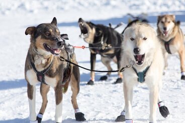
Iditarod Qualifier
200 Mile Race Overview
Race Route will be determined according to weather conditions and is subject to change
Trail Map
Rules 200 Mile
The trail of the 200 mile Caledonia Classic is an out and back trail run on the lake and through a network of bush trails. The race starts in the town of Fort St. James on the shores of Stuart Lake at the famous Cottonwood beach. Teams leave the starting chute and cross the lake traveling along the shoreline for eight miles passing several homes, a marina and two provincial parks.
After eight miles on the lake teams leave the lake and start in the bush trails. The next 20 miles, teams run northwest paralleling the lake. The trail has rolling hills, narrow sections, bridges and passes through some beautiful Douglas fir stands.
The trail eventually turns to the west and climbs gradually for approximately the next 15 miles. This section of trails is run along old forest service roads and reforested sites. At one point mushers can see three mountain ranges and are in an apex of three watersheds with water flowing north to Mackenzie River, south to the Fraser River system and west into the Skeena River system. This section of trail mushers will also be able to see two First Nations communities: Tache and Binche on the east side of the lake.
Eventually after more ups and downs, mushers will arrive at the “power line” checkpoint. Mushers can choose at this time to take a mandatory two hour rest or save it for their return trip. The checkpoint is primitive and will only provide a fire and water for teams.
After leaving the check point, teams will have a steep hill to climb for about two miles. The hill follows the power line up Mt. Nielsp. Musher fortunately do not have to summit the mountain as the trail turns to the south but continues to climb for about another 3 miles.
Eventually the trail does go down. It has a few hard turns on this section with one hairpin turn bringing teams onto a big cut block with a beautiful view of the Sowchea Creek Valley. Travel about five miles to the bottom of the valley and cross Sowchea Creek on a narrow bridge and start to climb again.
The climb continues for about 4 miles until you come to forest service road. You will not cross the road, but rather follow a windy trail close to the road for 5 miles. Here, you will cross the road. There will be a person stationed for safe crossing. This is also a dog drop.
Once you cross the road, you will go for about 7 miles, do a 4 mile loop and return on the same trail to the road crossing and down the hill to Sowchea Creek. After crossing the creek, you will take a right and after one short mile, you will end up at the Snowmobile Club House, which is the 6 hour layover.
The checkpoint has water, 2 bales of straw, and access to the drop bags. Mushers must take a mandatory 6 hour rest here. The checkpoint has vehicle access.
After six hours of rest teams get to repeat the adventure backwards!!